About
10+ years leveraging remote sensing and rapid prototyping techniques to provide innovative engineering solutions
Expertise
- Geomatics
- Applied Remote Sensing
- Uncertainty Propagation
- Research Design and Planning
- Sensor Characterization
- Rapid Prototyping
- Software & Algorithm Development
- System Design & Integration
- Data Analysis & Visualization
- Technical Reports & Presentations
Experience With
- Nearshore Oceanography
- Neural Networks
- Electrical Engineering
- Computer Vision
- Web Development
- PCB Design
Education
PhD in Civil Engineering - Geomatics
Research Focus: Applied Remote Sensing
BS in Mechanical Engineering
Experience
Sensor Lead
- Lead of the sensors team responsible for lidar, camera, radar, GNSS, and INS systems for autonomous trucks.
- Responsible for sensor characterization, selection, integration, and troubleshooting tasks.
- Heavily involved in sensor calibration processes.
- Collaborate internally with cross-functional teams and externally with sensor manufacturers.
- Regularly presenting to management and leadership.
Hardware Engineer
- Technical lead for radar and microphone systems.
- Responsible engineer for short-range lidar.
- Collaborated cross functionally to ensure sensor selection, placement, characterization, and integration.
- Frequently presented and communicated updates/results to management and external customers.
Graduate Research Assistant
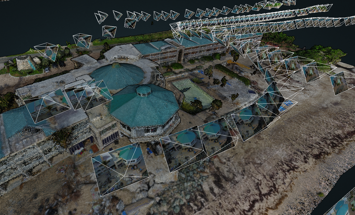
- Led experiments to assess Structure from Motion Photogrammetry accuracy in topographic and bathymetric settings
- Designed and integrated custom geospatial mapping systems incorporating lidar, photogrammetry, and GNSS
- Guest lecturer in various graduate level classes
Founder
- Developed hardware and processing software for a multi-camera nearshore coastal mapping system.
- Successfully transitioned system, methods, and algorithms to the U.S. Army Corps of Engineers, where it became a successful program.
Lidar Scientist
- Conceived a portable, tower-based system to rectify lidar, RGB cameras, and thermal camera for coastal and river analyses.
- Developed processing algorithms for accurate quantification of coastal erosion and river current velocities.
- Automated acquisition, processing, and co-registration procedures for lidar data.
- Established methods for hourly monitoring of coastal erosion and wave dynamics through data analysis and visualization.
Research Scientist
- Developed C++ scripts to interface with Riegl terrestrial lidar scanners for automated hourly scans.
- Responsible for mission planning, system setup, data collection, data processing, and data analysis of mobile lidar and radar systems.
Skills
I have spent 10+ years designing and executing robust experiments to observe real world processes and perform accuracy assessments of sensors and new methodologies against ground truth data. I have a strong understanding of statistical analysis and error propagation, such that results from these experiments are confidently backed by statistical significance tests. I enjoy consolidating results into concise summaries with actionable recommendations, when applicable.
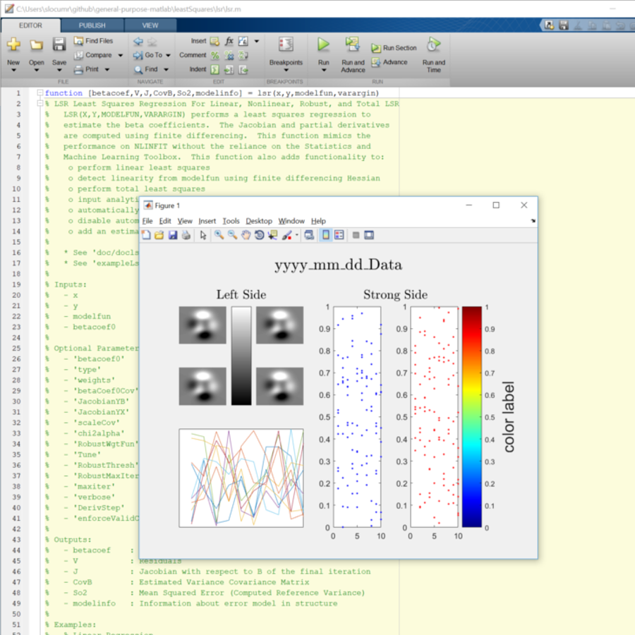
I am comfortable working on collaborative projects with version control, most commonly with Github. Most of my software development is in high level computing languages(MATLAB and Python), though I will occasionally use C++.
I enjoy designing and fabricating parts for custom systems. I most commonly use Autodesk Fusion 360 for designing 2D and 3D parts, which I then fabricate using a 3D Printer, Laser Cutter, or a CNC Router.
I am confident and have experience with many geospatial software packages. I used Agisoft Metashape extensively for my PhD research on Structure from Motion, though I have also used Pix4D. I commonly use CloudCompare for pointcloud visualization and interactive editing, and have traditionally avoided using Arc products in favor of writing custom MATLAB or Python scripts.
I have experience developing web pages, often building off of bootstrap templates and using libraries such as leaflet, potree, three.js, and more to visualize large geospatial datasets.
Portfolio
Polarimetric Camera UAS Testing
Designed, integrated, and tested a UAS mounted polarimetric camera and polarimetric acquisition methodology.
iPhone Lidar Accuracy Assessment
Performed assessment of the iPhone lidar, demonstrating through experiments the hybrid lidar + monocular depth estimation
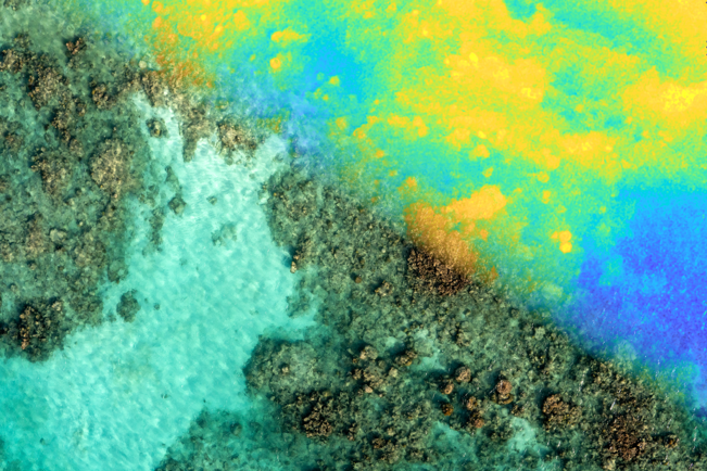
Radiometric-Geometric Bathymetry Mapping
Algorithm development leveraging radiometric and geometric methods with neural networks to improve UAS bathymetric mapping accuracy
VFX For Geospatial Data
Initial tests of camera tracking and using VFX to generate enhanced geospatial visualizations
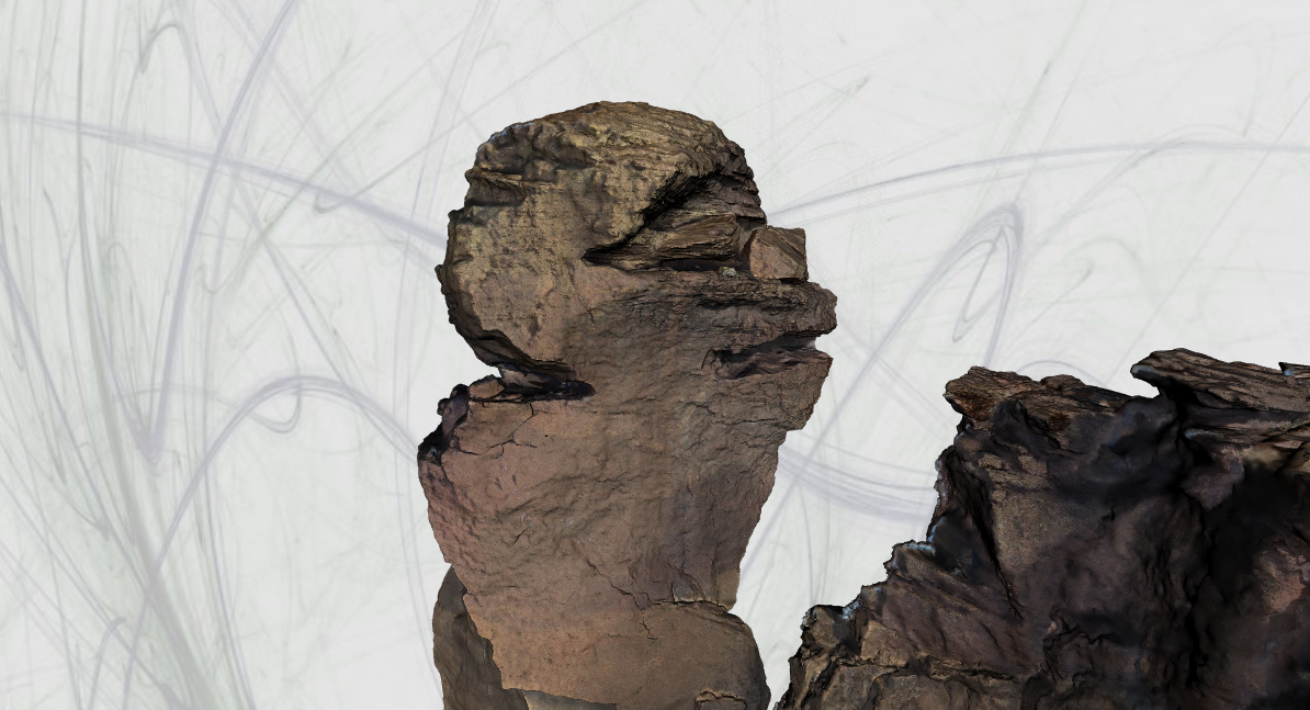
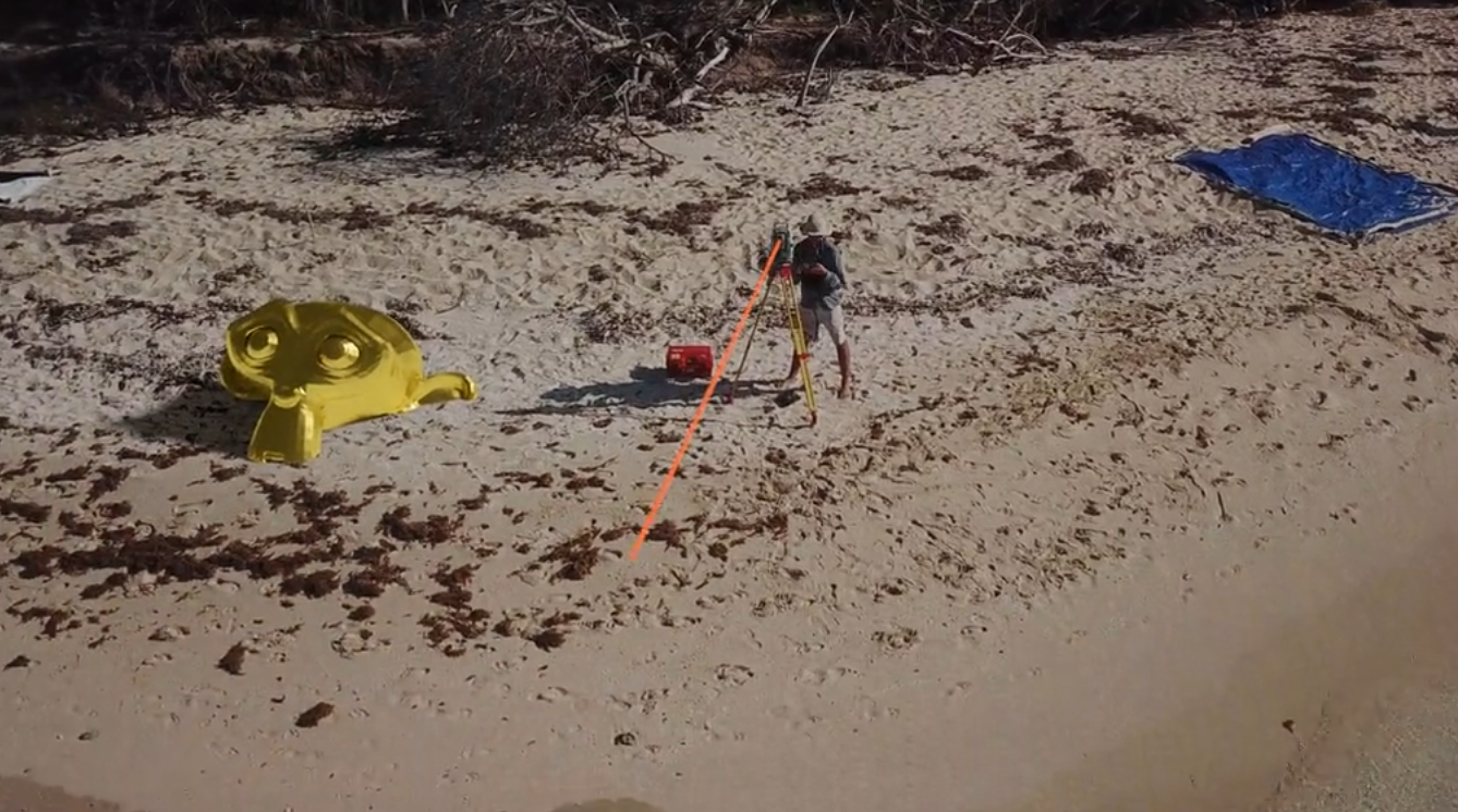
Monkey Mapper
Project to map and 3D print the iconic "monkey face" rock formation
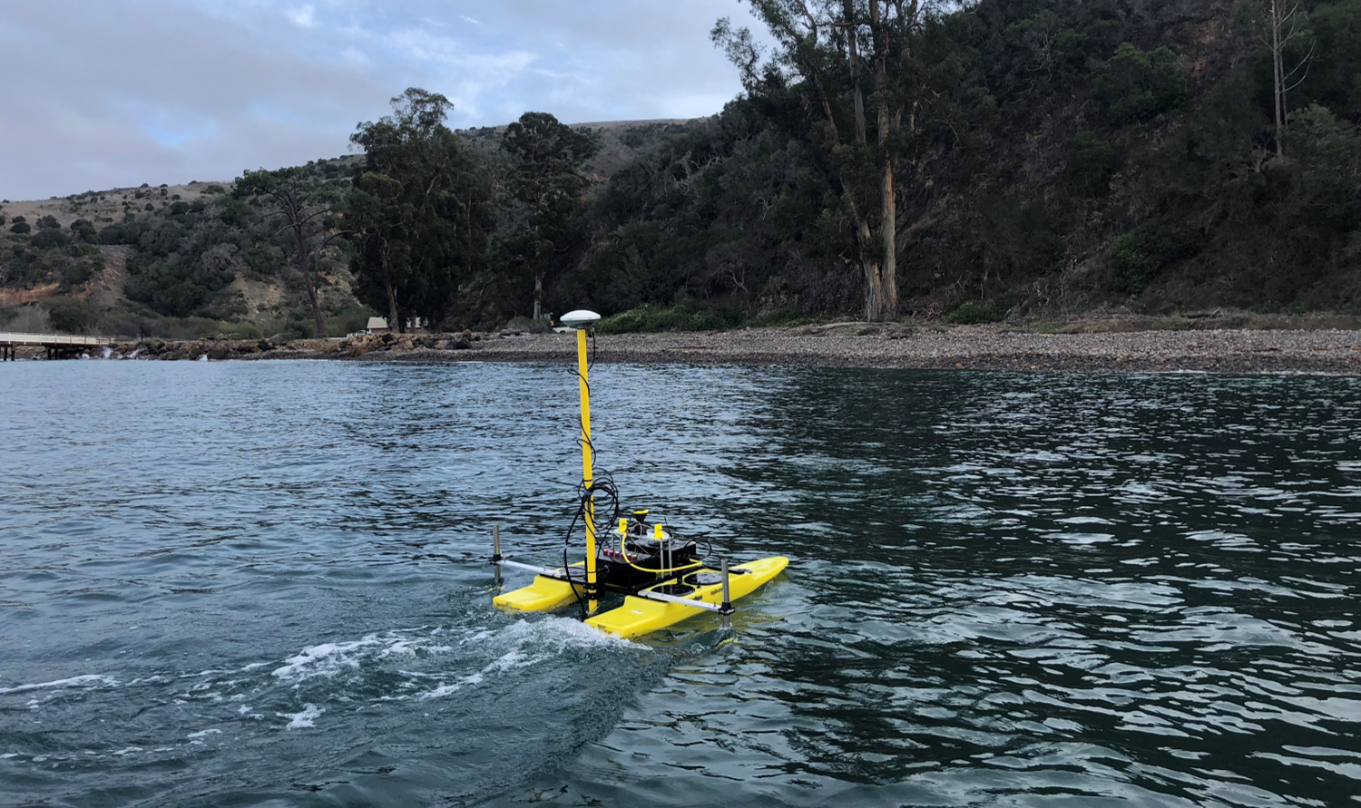
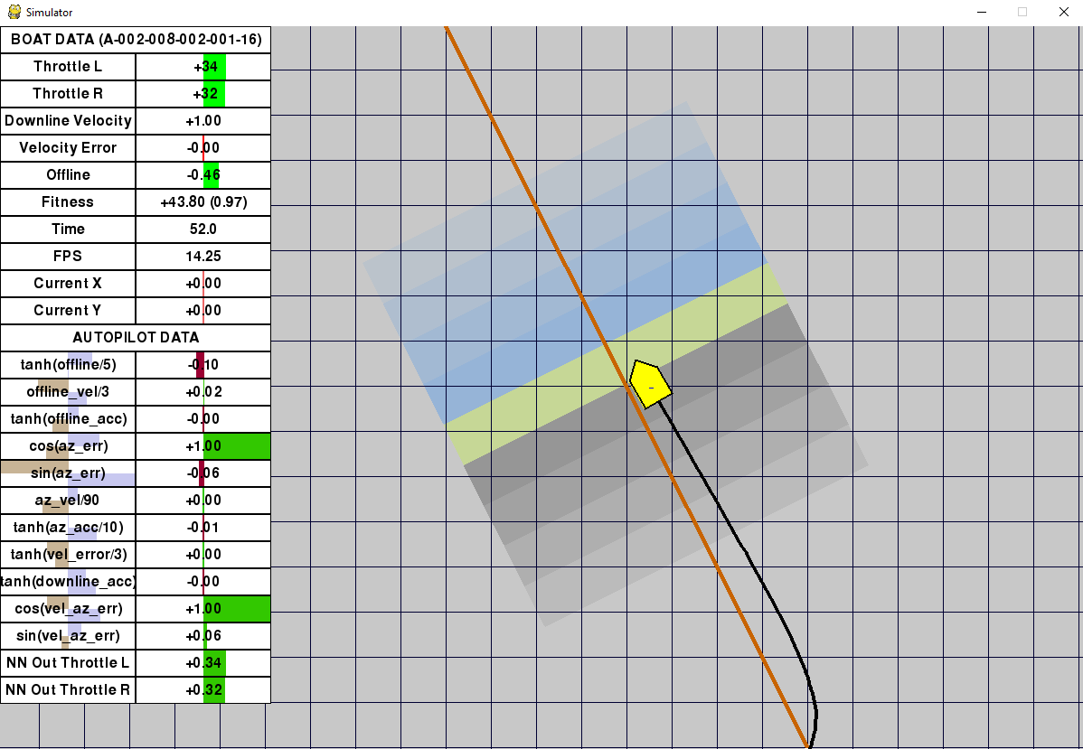
Autonomous Surface Vessel Design
Design, system integration, and data collection from a custom ASV for single beam sonar mapping
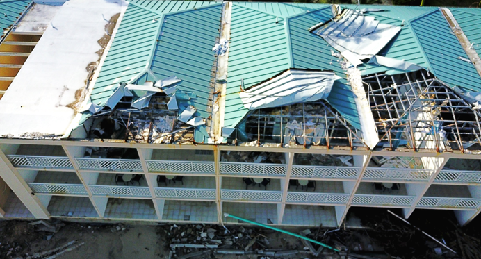
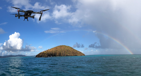
Disaster Rapid Response
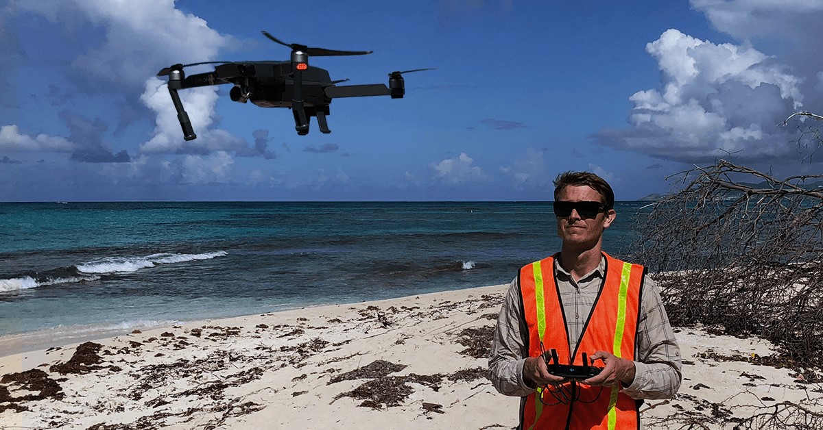
Deployment of survey equipment to assist with assessing storm surge and damage metrics in the USVI
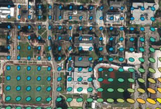
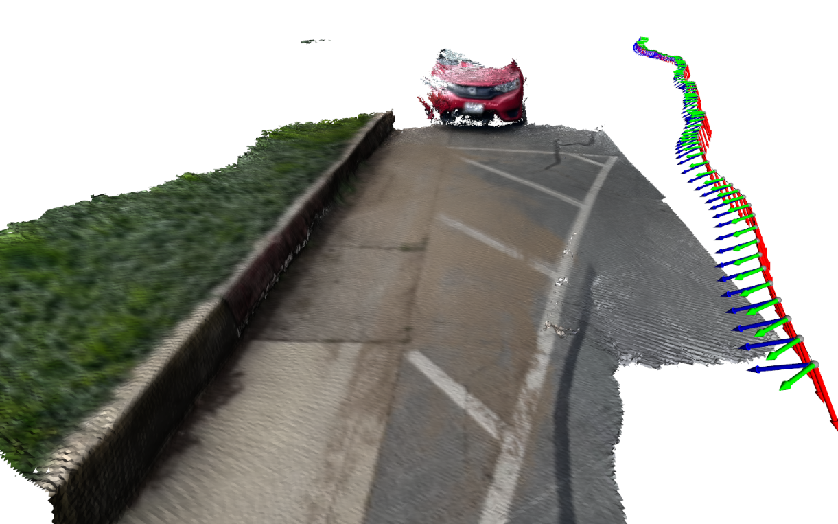
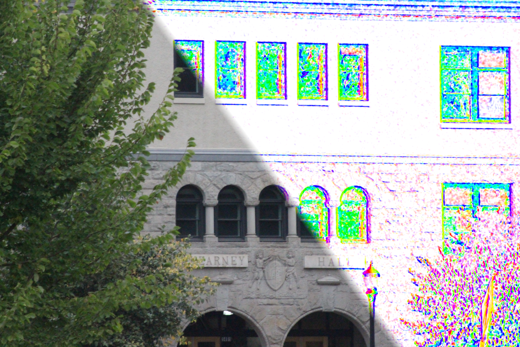
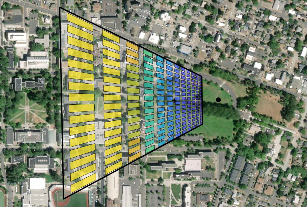
Orthophoto Uncertainty Estimation
Visualization of horizontal uncertainty ellipses of an orthophoto where the camera pose is computed via a space resection
Custom PPK Mapping UAS
Design, system integration, and data collection from a custom PPK enabled UAS for SfM mapping with fewer GCPs
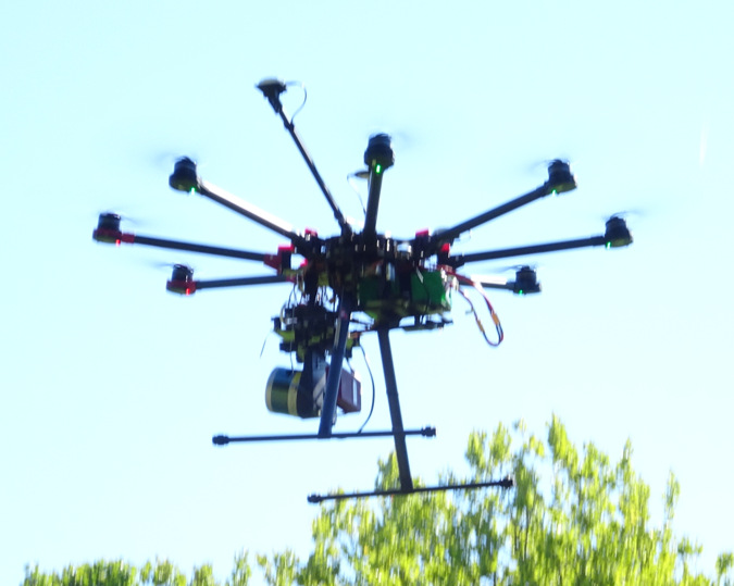
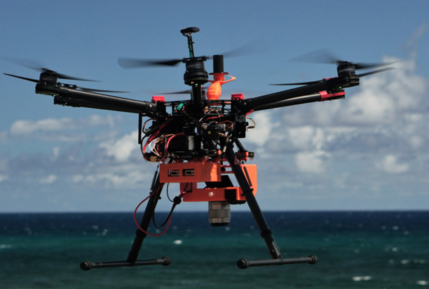
Custom UAS Lidar System
Design, system integration, data processing for a velodyne mounted on a DJI S1000 airframe

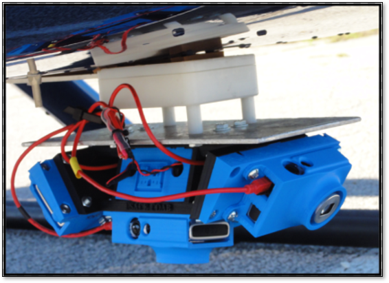
Multi-Camera Surf Zone Mapper
Concept design and development of hardware and algorithms for low cost surf zone mapping system
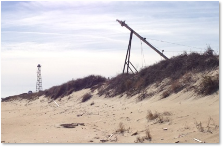
Portable Inlet Monitoring Tower
Design, integration, and fieldwork of a portable tower with a lidar scanner and multiple EO/LWIR cameras
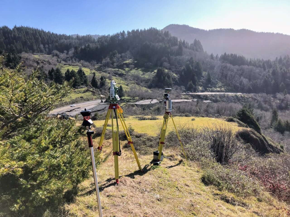
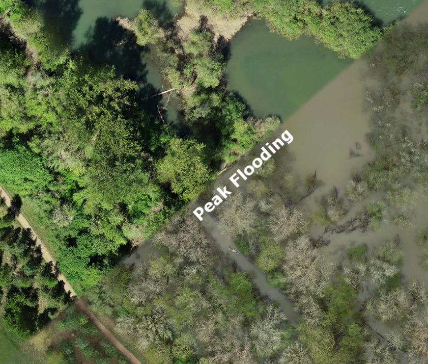
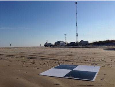
Automated Coastal Lidar System
Development of acquisition, registration, and processing pipeline for a dune mounted terrestrial lidar scanner
Interests
When I'm not working, I enjoy: surfing, rock climbing, mountain biking, kayaking, canyoneering, training for triathalons, golfing, camping, and really anything that gets me outside.
When the weather isn't cooperating, I don't mind staying inside and tapping into my creative side. I have a laser cutter, CNC router, and 3D printer in my living room and enjoy having friends over to build whatever we can think of.